Chapter 17. Glaciation
Adapted by Joyce McBeth, University of Saskatchewan
from Physical Geology by Steven Earle

Learning Objectives
After reading this chapter and answering the review questions at the end, you should be able to:
- Define, draw, and describe the major features of glaciers
- Explain the differences between continental and alpine glaciation
- Summarize how snow and ice accumulate above a glacier’s equilibrium line and are converted to ice
- Explain how basal sliding and internal flow facilitates the movement of ice from the upper part to the lower part of an alpine glacier
- Describe and identify the various landforms related to alpine glacial erosion, including U-shaped valleys, arêtes, cols, horns, hanging valleys, truncated spurs, drumlins, roche moutonnées, glacial grooves, and striae
- Identify various types of glacial lakes, including tarns, finger lakes, moraine lakes, and kettle lakes
- Describe the nature and origin of lodgement till and ablation till
- Describe the nature and origin of glaciofluvial, glaciolacustrine, and glaciomarine sediments
- Describe the timing and extent of Earth’s past glaciations, going as far back as the early Proterozoic
- Describe the important geological events that led up to the Pleistocene glaciations
- Explain how the Milankovitch orbital variations along with positive climate feedback mechanisms may have controlled the timing of the Pleistocene glaciations
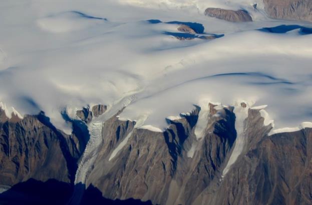
A glacier is a long-lasting (decades or more) body of ice that is large enough to move under its own weight. They are at least tens of metres thick and at least hundreds of metres in extent. About 10% of Earth’s land surface is currently covered with glacial ice, and although the vast majority of this is in Antarctica and Greenland, there are many glaciers in Canada, especially in the mountainous parts of BC, Alberta, and the Yukon, and in the far north (Figure 17.1). At various times during the past million years, glacial ice has been much more extensive, covering at least 30% of the Earth’s land surface at times.
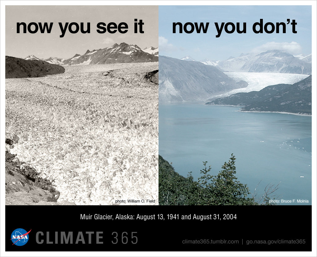
Glaciers currently represent the largest repository of fresh water on Earth (~69% of all fresh water). They are highly sensitive to changes in climate, and in recent decades have been melting rapidly worldwide (Figure 17.2). Although some of the larger glacial masses may still last for several centuries, smaller glaciers, including many in western Canada, may be gone within decades. For mountainous regions, glaciers are an important sources of drinking water. Rapid glacial melting is a troubling issue for western Canadians because glacial ice is an important part of the hydrologic cycle in glaciated regions. Irrigation systems in BC, and across Alberta and Saskatchewan, are replenished by meltwater originating from glaciers in the Coast Range and the Rocky Mountains.


