
11.7 Monitoring Volcanoes and Predicting Eruptions
In 2005 U. S. Geological Survey geologist Chris Newhall made a list of the six most important signs of an imminent volcanic eruption. They are:
- Gas leaks — the release of gases (mostly H2O, CO2, and SO2) from the magma into the atmosphere through cracks in the overlying rock
- Bulging — the deformation of part of the volcano, indicating that a magma chamber at depth is swelling or becoming more pressurized
- Seismicity — many (hundreds to thousands) of small earthquakes, indicating that magma is on the move. The quakes may be the result of the magma forcing the surrounding rocks to crack, or a harmonic vibration that is evidence of magmatic fluids moving underground.
- Seismicity ceases — a sudden decrease in the rate of earthquake activity. This may indicate that magma has stalled, and that\ something is about to give way
- Big bump — a pronounced bulge on the side of the volcano (like the one at Mt. St. Helens in 1980), which may indicate that magma has moved close to surface
- Steam — steam eruptions ( phreatic eruptions) that happen when magma near the surface heats groundwater to the boiling point. The water eventually explodes, sending fragments of the overlying rock far into the air.
With these signs in mind, we can make a list of the equipment we should have and the actions we can take to monitor a volcano and predict when it might erupt.
Assessing Seismicity
The simplest and cheapest way to monitor a volcano is with seismometers, instruments that detect vibration. In an area with several volcanoes that have the potential to erupt (e.g., the Squamish-Pemberton area), a few well-placed seismometers can provide an early warning that something is changing beneath one of the volcanoes. There are currently enough seismometers in the Lower Mainland and on Vancouver Island to provide this information. You can view a map of Canadian National Seismograph Network here.
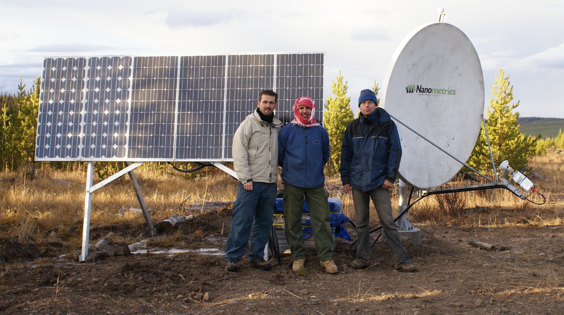
If there is seismic evidence that a volcano is coming to life, more seismometers should be placed in locations within a few tens of kilometres of the source of the activity (Figure 11.42). This will allow geologists to determine the exact location and depth of the seismic activity so that they can see where the magma is moving.
Detecting Gases
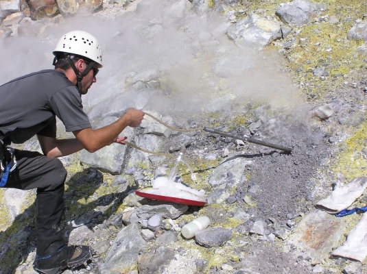
Water vapour quickly turns into clouds of liquid water droplets and is relatively easy to detect just by looking, but CO2 and SO2 are not as obvious. It’s important to be able to monitor changes in the composition of volcanic gases, and we need instruments to do that. Some can be monitored from a distance (from the ground or even from the air) using infrared devices, but to obtain more accurate data, we need to sample the air and do chemical analysis. This can be achieved with instruments placed on the ground close to the source of the gases, or by collecting samples (Figure 11.43) and analyzing them in a lab.
Measuring Deformation
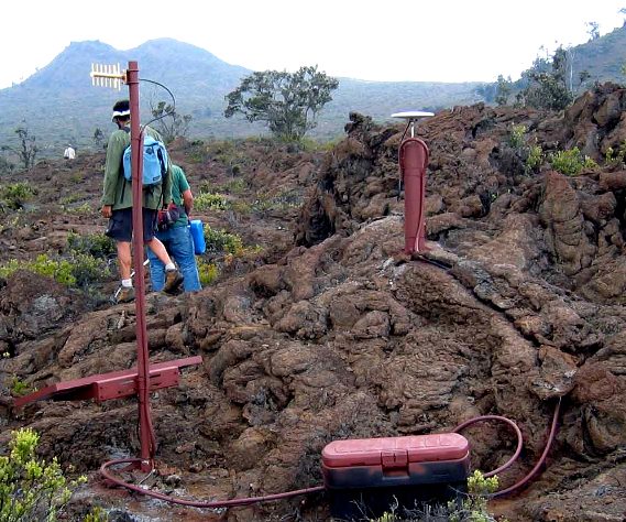
There are two main ways to measure ground deformation at a volcano. One is known as a tiltmeter, which is a sensitive three-directional level that can sense small changes in the tilt of the ground at a specific location. Another is through the use of GPS (global positioning system) technology (Figure 11.44). GPS is more effective than a tiltmeter because it provides information on how far the ground has actually moved — east-west, north-south, and up-down.
Putting It All Together
By combining information from these types of sources, along with careful observations made on the ground and from the air, and a thorough knowledge of how volcanoes work, geologists can get a good idea of the potential for a volcano to erupt in the near future (months to weeks, but not days). They can then make recommendations to authorities about the need for evacuations and restricting transportation corridors.
Our ability to predict volcanic eruptions has increased dramatically in recent decades because of advances in our understanding of how volcanoes behave and in monitoring technology. Providing that careful work is done, there is no longer a large risk of surprise eruptions, and providing that public warnings are issued and heeded, it is less and less likely that thousands will die from sector collapse, pyroclastic flows, ash falls, or lahars. Indirect hazards are still very real, however, and we can expect the next eruption like the one at Laki in 1783 to take an even greater toll than it did then, especially since there are now roughly eight times as many people on Earth.
