
11.8 Volcanoes in Canada
Canada’s volcanically active regions are located in British Columbia and the Yukon Territory (Figure 11.45). At least 49 eruptions have occurred within these regions in the last 10,000 years. There are five volcanic regions associated with three types of plate tectonic settings: a subduction zone, a mantle plume, and a continental rift zone.
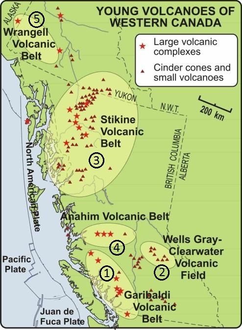
Subduction Zone Volcanism: Wrangell and Garibaldi Volcanic Belts
The Wrangell Volcanic Belt is the result of subduction beneath the North American Plate. Volcanoes in the Canadian part of the Wrangell Volcanic Belt erupted between 17.8 and 10.4 million years ago. They were fed by lava that seeped up along a leaky transform fault.
Southwestern British Columbia is at the northern end of the Juan de Fuca subduction zone, and part of the Cascade Volcanic Arc that extends south through Washington and Oregon. The Canadian part of the Cascade Arc has had a lower rate and volume of volcanism than U. S. portions. One reason is that the northern part of the Juan de Fuca Plate is subducting more slowly than the rest of the plate, or else has stalled.
The Garibaldi Volcanic Belt has several volcanic centres , or regions where volcanism has caused multiple volcanoes to develop (Figure 11.46).
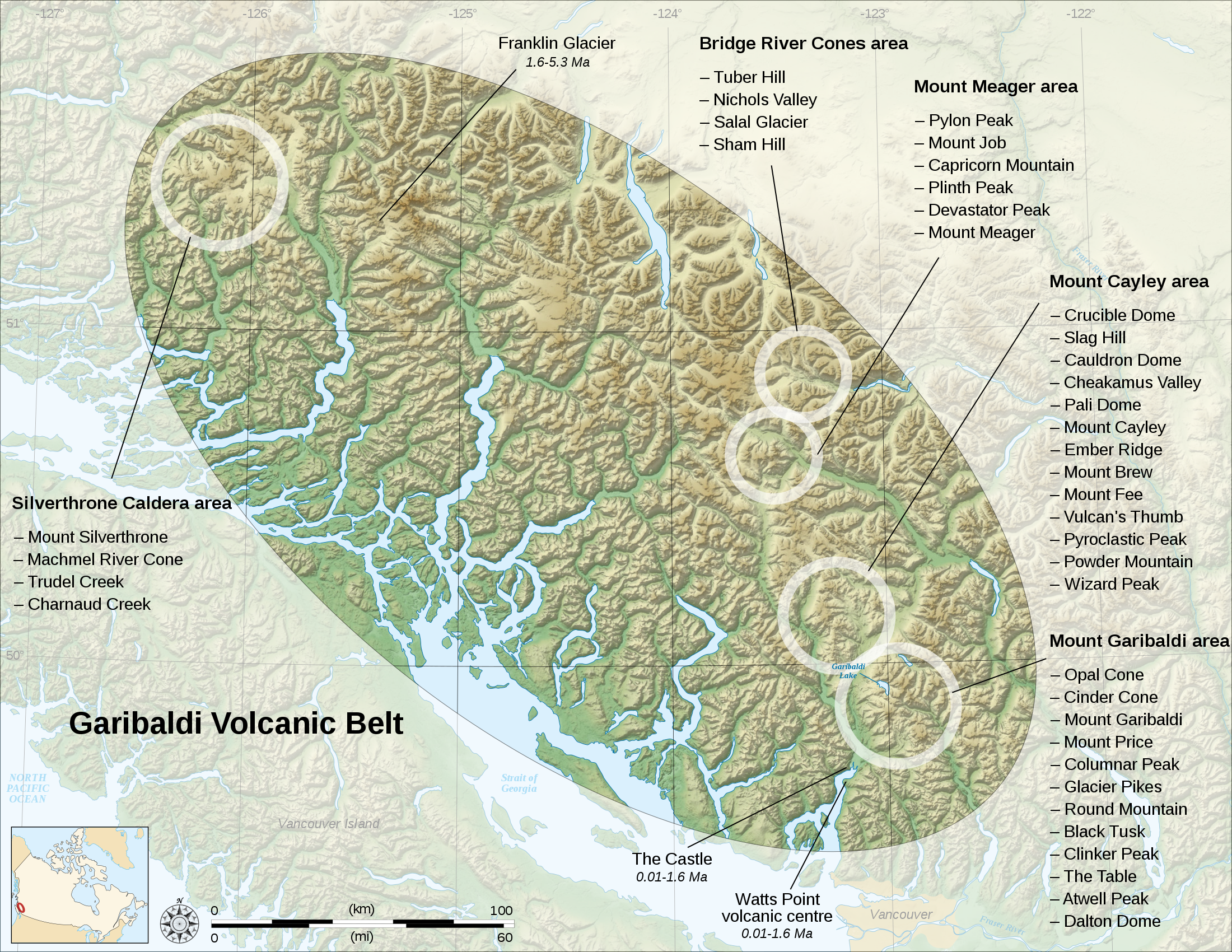
The most recent volcanic activity in this area was 2,350 years ago at Mt. Meager. An explosive eruption similar in magnitude to that of Mt. St. Helens in 1980 spread ash as far east as Alberta. There was also significant volcanic activity at Mt. Price and Mt. Garibaldi approximately 10,000 years ago as glacial ice receded. In both cases, lava and tephra built up against glacial ice. The western side of Mt. Garibaldi failed by sector collapse when the ice melted, leaving rocks unsupported. Eruption beneath glacial ice resulted in the formation of a tuya– a steep-sided, flat-topped volcano- called The Table near Mt. Garibaldi (Figure 11.47).

Mantle Plume Volcanism: Anahim Volcanic Belt
The chain of volcanic complexes and cones extending from Milbanke Sound to Nazko Cone is interpreted as being related to a mantle plume currently situated close to the Nazko Cone, just west of Quesnel (Figure 11.48). The North American Plate is moving in a westerly direction at about 2 cm per year with respect to this plume, and the series of now partly eroded shield volcanoes between Nazco and the coast is interpreted to have been formed by the plume as the continent moved over it.
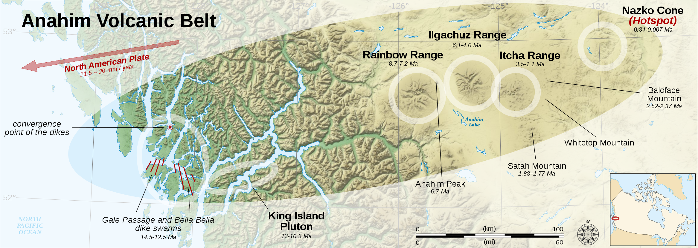
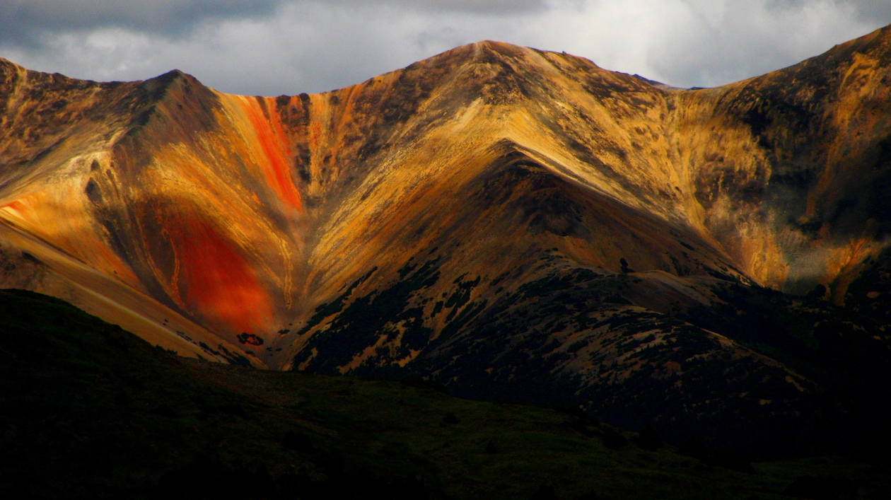
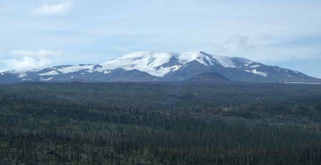
The Rainbow Range, which formed at approximately 8 Ma, is the largest of these older volcanoes. It has a diameter of about 30 km and an elevation of 2,495 m (Figure 11.49). The name “Rainbow” refers to the bright colours displayed by some of the volcanic rocks as they weather.
Rift-Related Volcanism: Wells Gray-Clearwater Volcanic Field and Stikine Volcanic Belt
While British Columbia is not about to split into pieces, two areas of volcanism are related to rifting, or at least to stretching-related fractures that might extend through the crust. These are the Wells Gray-Clearwater volcanic field southeast of Quesnel (Figure 11.50), and the Stikine Volcanic Belt (also called the Northern Cordillera Volcanic Province), which ranges across the northwestern corner of the province.
The Stikine Volcanic Belt includes Canada’s most recent volcanic eruption, a cinder cone and mafic lava flow that formed around 250 years ago at the Tseax River Cone in the Nass River area north of Terrace. According to Nisga’a oral history, lava overran a village on the Nass River, and 2,000 people were lost. The region is now part of the Anhluut’ukwsim Laxmihl Angwinga’asanskwhl Nisga’a (Nisga’a Memorial Lava Bed Park).
The Mount Edziza Volcanic Field near the Stikine River is a large area of lava flows, sulphurous ridges, and cinder cones. The most recent eruption in this area was about 1,000 years ago. While most of the other volcanism in the Edziza region is mafic and involves lava flows and cinder cones, Mt. Edziza itself (Figure 11.51) is a composite volcano with rock compositions ranging from rhyolite to basalt. A possible explanation for the presence of composite volcanism in an area dominated by mafic flows and cinder cones is that there is a magma chamber beneath this area, within which magma differentiation is taking place.
References
Geological Survey of Canada (n.d.) Catalog of Canadian Volcanoes: Anahim volcanic belt Visit website
Geological Survey of Canada (n.d.) Catalog of Canadian Volcanoes: Garibaldi volcanic belt: Garibaldi Lake volcanic field Visit website
Skulski, T., Francis, D., & Ludden, J. (1991) Arc-transform magmatism in the Wrangell volcanic belt. Geology (19)1, 11-14. doi:10.1130/0091-7613(1991)019<0011:ATMITW>2.3.CO;2
Trop, J. M., Hart, W. K., Snyder, D., & Idleman, B. (2012). Miocene basin development and volcanism along a strike-slip to flat-slab subduction transition: Stratigraphy, geochemistry, and geochronology of the central Wrangell volcanic belt, Yakutat-North America collision zone. Geosphere (8)4, 805-834. doi:10.1130/GES00762.1
Volcanoes Canada, Canadian Hazards Information System, Natural Resources Canada (n.d.). Where Are Canada’s Volcanoes? Visit website
