
13.5 Measuring Geological Structures
Documenting the characteristics of geological structures is used to understand the geological history of a region. One of the key features to measure is the orientation, or attitude, of bedding. We know that sedimentary beds are deposited in horizontal layers, so if the layers are no longer horizontal, then we can infer that tectonic forces have folded or tilted them.
The orientation of a planar feature, such as a bed of sedimentary rock, can be described with two values. The strike of the bed is the compass orientation of a horizontal line on the surface of the bed. The dip is the angle at which the surface tilts down from the horizontal (Figure 13.35). The dip is measured perpendicular to strike, otherwise the dip angle that is measured will be smaller than the actual tilt of the bed.
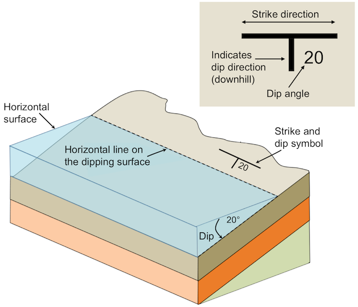
It may help to imagine a vertical surface, such as a wall in your house. The strike is the compass orientation of the wall and the dip is 90˚ from horizontal. If you could push the wall so it is leaning over, but still attached to the floor, the strike direction would be the same, but the dip angle would be less than 90˚. If you pushed the wall over completely so it was lying on the floor, it would no longer have a strike direction because you could draw a horizontal line in any of an infinite number of directions on the horizontal surface of the wall. Its dip would be 0˚.
When reporting the dip, include the direction. For example, if the strike runs north-south and the dip is 30˚, it would be necessary to specify “to the west” or “to the east.” Similarly if the strike is northeast-southwest and the dip is 60˚, it would be necessary to say “to the northwest” or “to the southeast.” In the case of the vertical wall with a dip angle of 90˚, there is no dip direction. The dip points straight down, not toward any compass direction.
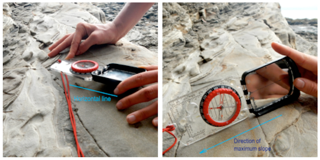
Measurement of geological features is done with a special compass that has a built-in clinometer, which is a device for measuring vertical angles. The strike is measured by aligning the compass along a horizontal line on the surface of the feature (Figure 13.36, left). The dip is measured by turning the compass on its side and aligning it along the dip direction (Figure 13.36, right).
Strike and dip are used to describe any other planar features, including joints, faults, dykes, sills, and even the foliation planes in metamorphic rocks. Figure 13.37 shows an example of how we would depict the beds that make up an anticline on a map. The beds on the west (left) side of the map are dipping at various angles to the west. The beds on the east side are dipping to the east. The beds in the middle are horizontal; this is denoted by a cross within a circle on the map. The dyke is dipping at 80˚ to the west. The hinge line of the fold is denoted with a dashed line on the map, with two arrows pointing away from it, indicating the general dip directions of the limbs. If it were a syncline, the arrows would point inward toward the line.

Exercise: Putting Strike and Dip on a Map
This cross-section shows seven tilted sedimentary layers (a to g), a fault, and a steeply dipping dyke.
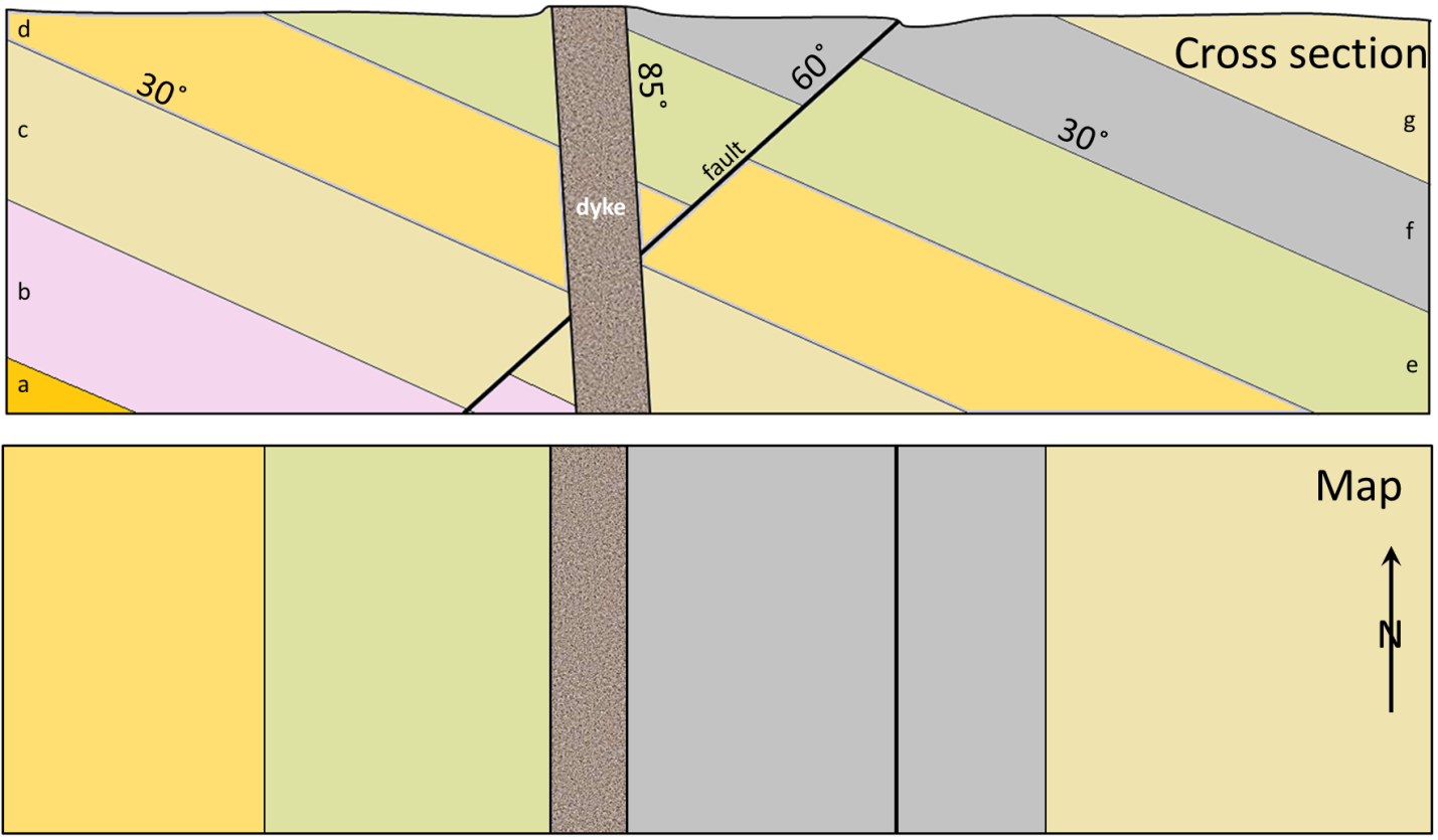
- Place strike and dip symbols on the map to indicate the orientations of the beds shown, the fault, and the dyke.
- What type of fault is shown?
- What kind of stress created the fault?
